


Vancouver, B.C. public transit with a pet: Sightseeing by bus, SkyTrain, and SeaBus
My grandfather, an otherwise elegant man, was a devoted fan of sightseeing buses. He acknowledged their faults, but insisted that there is no better way to get an overview of a new city, its history, and its main attractions. In time, I learned to agree. A bus, moreover, is a great alternative for tourists on soggy days, or as a break when you’ve walked your feet into stumps. Here’s the problem, though: While some hop-on, hop-off bus companies allow you to board with your small dog in a carrier (Paris’s Les Cars Rouges and L’Open Tour buses come to mind), many don’t. Vancouver, B.C.’s Big Bus/Pink Bus doesn’t, it turns out — but Vancouver’s public transit is pet-friendly, and with ingenuity, you can create your own tour of the city.
A few useful tips: Small pets in carriers are allowed on all forms of Vancouver public transit except HandyDART. Most of the neighborhoods a tourist is likely to visit are in Zone 1; the SeaBus ride is in Zone 2, and so is the ride to Horseshoe Bay, so for those you’ll need to buy a separate ticket or figure out Add Fare. Faresaver ticket packets ($21 for 10 Zone-1 tickets) can be purchased at little newsstands, or, more reliably, at drugstore chains like London Drug. The front door of the bus will pull up right in front of its street sign; people queue for the bus, so be sure to fall in at the end of the line. You validate your ticket at the front of the bus, and at standalone machines near the SkyTrain ticket machines (depending on how you’re traveling).
Many of the stops on the Big Bus/Pink Bus route are at downtown hotels, so the tour really focuses on a handful of attractions. They fall into groupings that you can easily visit by public transit:
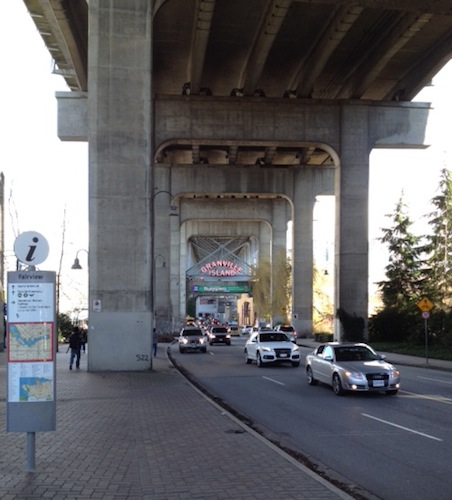
Stanley Park — Bus route #19 deposits you just beyond the Stanley Park Pavilion. From there, you can easily reach all kinds of park loveliness. Heading in the other direction, route #19 exits the park via Georgia and Pender, traverses downtown, and then turns south in Chinatown (on Main St., just past the Dr. Sun Yat-Sen Chinese Garden). Between 7th and 8th, it veers southeast on Kingsway (ending at the Metrotown SkyTrain stop), so it’s not an ideal route to take you to the antique shops, etc. on South Main (the #3 bus is the right choice for Antique Row: The shops are now strung out along Main Street, so you can find good stuff anywhere north of Marine).
Robson Street shopping — Chloe and I caught the #5 bus on Richards St., just uphill from Hastings, and rode it to its terminus (20 minutes, tops). While you’re still on Hastings, look to the left to see the Colisseum-like library (one of the Big Bus sights). Soon afterwards, you’ll turn right on Robson; in a couple of blocks, look left when you cross Granville to see a clutch of great old movie theater signs, including the “Orpheum.” You’ll pass Robson Square, you’ll turn left on Denman (and pass some nice-looking cafés), and you’ll eventually ease to a halt at Denman & Davie.
Second Beach, English Bay Beach, and Beach Avenue — After stepping off the #5, you could walk up the street a block to the stop for the #C21 bus — or you could, as we did, turn right towards the water. Chloe and I walked downhill to English Bay Beach, and then turned south along False Creek (if you want to catch another of the Big Bus sights, you could instead turn north along the water and make your way to Second Beach before returning south). After a while we clambered back up to Beach Ave. and caught the #C21 later on its route.
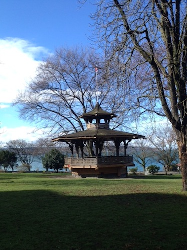
This lovely gazebo is in a park just above English Bay Beach, and just downhill from the end of the #5 bus route.
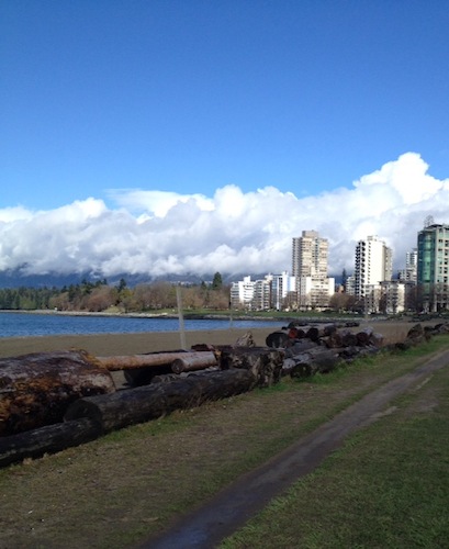
English Bay Beach in the foreground, with Second Beach in the distance to the left.
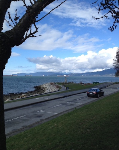
The view out to English Bay from Beach Ave. (waiting for the #C21 bus)
Please note that the #C21 is a smaller bus — still comfortable, but you should be looking for a van rather than a big city bus. When you get in, sit in a seat on the right. If you’d like to hop over to Granville Island (which you’ll start seeing as soon as you turn south from English Bay Beach), you could get off at the Beach & Bute or Thurlow stops, and walk down to catch one of the bathtub toy ferries.
Granville Island, from English Bay Beach, on a day so bright that my phone camera just stopped trying.
If you remain aboard, the #C21 turns left on Howe, away from the water, and then follows Pacific to the Yaletown-Roundhouse SkyTrain stop. Chloe and I got out and walked around Yaletown for a little while before taking the SkyTrain back to the conference center (Waterfront station). Our original bus ticket had not expired, so we fit three trips (two bus rides and a subway trip) into one $2.10 fare.
Granville Street (downtown) — You saw part of the Granville Entertainment District from the #5 bus, but quite a few buses will take you down the length of Granville, giving you more time to see its theater signs and shops. I chose the #50, which leaves from the convention centre area and goes, conveniently, to the south end of Granville Island.
Granville Island — Please note that while you can walk to Granville Island from the north (that is, from downtown), it’s tricky. There are good views from the Granville Street Bridge, but there’s also fast-moving traffic right next to you — and when you reach the south side of the bridge, there’s no easy trail to the island. A better choice is to walk or take the SkyTrain or a bus to the edge of False Creek and then catch a little ferry to the island. An even easier option is to take the #50 bus to the south end of the bridge: Get off at the 2nd & Anderson stop, walk forward to the corner, and cross the street.
As you’re crossing the street, one of those big pillars blocks your view of the Granville Island sign — keep walking forward and you’ll see it.
Gastown — Gastown is an easy walk from the convention center, so I didn’t road-test any buses for you. Many routes go to/through Gastown, however, including the #50 — handy for tourists because it also swings through part of Chinatown and goes to the southern end of Granville Island. Alternatively, you could take the SkyTrain to the Waterfront station: When you exit the building (follow the signs for Cordova St.), turn left.
Chinatown — Chinatown is also an easy walk from the convention center (it’s just beyond Gastown), but by now you know that the #19 would be a good choice. The #22 would also give you good views of the neighborhood, since it travels down Pender (I’d turn around at Gore St. and head back again — if you stay on #22 as it passes back through downtown, it’ll take you to Cornwall Avenue in the appealing Kitsilano neighborhood).
In fact, you can easily take the bus or the SkyTrain to intriguing neighborhoods/locations the Big Bus doesn’t visit:
Yaletown — The #C21 bus, which you now know about, takes you to the heart of Yaletown, which looks a lot like NYC’s Meatpacking District, and is, like it, full of tasty restaurants and shops. Another good option is the #C23 bus, which will carry you along Davie St., parallel to the #C21 route. A fun option would be to take the SkyTrain to the Yaletown-Roundhouse stop, catch the #C23 heading northwest, and then return on the #C21 (with the English Bay Beach break I described above). If you detour to Granville Island, you could return to downtown on the #50 bus.
East Vancouver — Chloe and I walked the #20 bus route from the waterfront to Commercial Drive, and while there are some good old neon signs on Hastings, there are also blocks of grim urban grit.
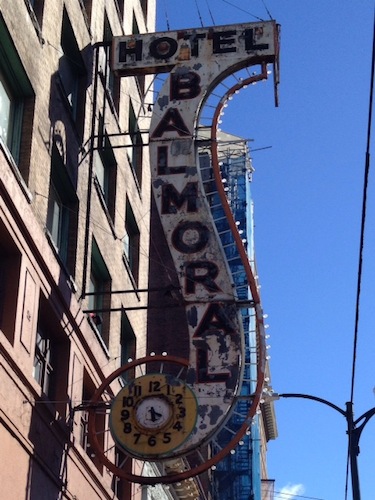
One of several terrific neon signs on Hastings (also not to be missed: the signs for Save-On Meats, Hotel Empress, and Ovaltine Café).
The #20 does, however, take you down the full length of Commercial, a cheerful strip of funky shops, cafés, groceries, and bakeries. I’d get off at Venables and walk all the way down to Broadway, and then catch the SkyTrain back to downtown (the station is at Commercial and Broadway — you can see the overhead tracks from a few blocks away as you walk south).
Kitsilano — This neighborhood, southwest of downtown, has the same laid-back vibe of West Seattle. Chloe and I spent a fun morning taking the #44 bus from downtown across the Burrard Bridge and then all the way west on 4th Ave. (one of Kitsilano’s two main thoroughfares) to the University of British Columbia’s beautiful campus. Sit on the right side of the bus to catch glimpses of English Bay and Jericho Beach Park. The east end of 4th Avenue is packed with shops and restaurants: Get off at 4th and Burrard, soon after you cross the bridge, and walk west until you get tired of walking, and then hop back on the bus.
Consider returning, as we did, on the express #99-B bus (it leaves from Bay 2, near where #44 lets you off). It scoots quickly down Broadway, the second of Kitsilano’s fun shopping streets. Sit on the left side of the bus and look for the lovely intermittent views of downtown. I suggest getting off at the Alma stop and then walking east (stopping at Notte’s Bon Ton bakery en route, if you can — the service is cruel, but the baked goods are divine) to the Macdonald stop or perhaps as far as the Arbutus stop. Beyond that, the charm fades.
One warning: When you get on the #99-B at UBC, immediately find a seat — as soon as the bus takes off, it executes this appalling right turn that will hurl you and your dog onto the unsuspecting lap of a college student. Who will be extremely polite and forgiving, but still, dang. Glad it happened to that other lady and her dog and not, ahem, to me….
Granville St. (residential) — I have to thank this post for getting me started on finding scenic public transit routes around Vancouver. One idea I didn’t explore (but will next time I visit!) was taking the #10 bus south from downtown along Granville Street to looky-loo at grand old houses. There are few things I enjoy more than viewing historic homes, and this street is lined with them. I’ll be sitting on the right side of the bus in both directions, and I’ll seek out the higher seats in the back of the bus, so I have a better chance of seeing over hedges.
Horseshoe Bay — Another good idea from Julie Ovenell-Carter that I didn’t have time to execute. The #250 bus requires a Zone 2 fare, so buy your ticket or add fare accordingly. I’ll be sitting on the left side of the bus heading west, and then on the right side on the return trip, to get water views in both directions.
And why stop there? Why not take a mini-cruise across Coal Harbour, via the SeaBus? It’s a Zone 2 trip, so I bought a separate ticket at the machine in the lobby of the Waterfront station (the ticket lasts for 90 minutes, which gave us plenty of time to cross, shop and eat, and return). In both stations, walk down the ramp to the waiting area; a count-down clock at the bottom of the ramp tells you how close your ride is. Please note that the boat is double-ended; that is, it does not turn around after pulling out of dock. To look at North Vancouver as you’re approaching it, enter the boat and turn right; to look at downtown as you’re approaching it, enter the boat and turn left. Both are well worth looking at.
There is a nice little market of eateries, groceries, and craft shops at Lonsdale Quay, and it was a delightful lunchtime excursion taking the SeaBus across the harbor, picking up lunch, and eating it in the market plaza while gazing at downtown. Pet dogs are not allowed in the market, but if you’re traveling with a friend, one of you could get lunch; alternatively, you could pack a picnic. I broke the rules and darted inside (with Chloe in her messenger bag) to pick up a burrito and a sack of mandarin oranges.

The plaza outside the Lonsdale Quay market — a fine place for lunch with your pup on a sunny day
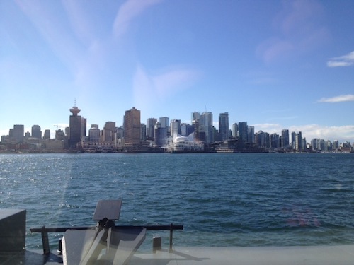
A view of downtown Vancouver from the SeaBus — other pictures I took, even more flawed than this one, included Stanley Park on the right and a goodly chunk of East Vancouver on the left. Bad photos, beautiful views.
Cobbling together a tour like this has its disadvantages: It’s a little more work than putting yourself in the hands of the tour operators (though I hope this post helps!) and you don’t get the benefit of the recorded guide. On the other hand, your small dog can keep you company, it’s significantly less expensive to take public transit, you see locals rather than other tourists, and you have a lot more flexibility (if your eye is caught by a shop halfway down Robson, for example, you can get off instantly, rather than waiting for the designated stop). There are apps for your phone that will help you plan your trip and track your buses, but I had good success doing advance research on translink.ca and consulting my pocket-sized paper transit map en route (available where you buy your ticket packets).
Have I missed a Vancouver bus route that you love? Please add a comment, so we can all add it to our list of must-dos!